

|
|
|
THE DURIS ENIGMA |
This web page was originally constructed to try and locate information about Mr. Duris whose
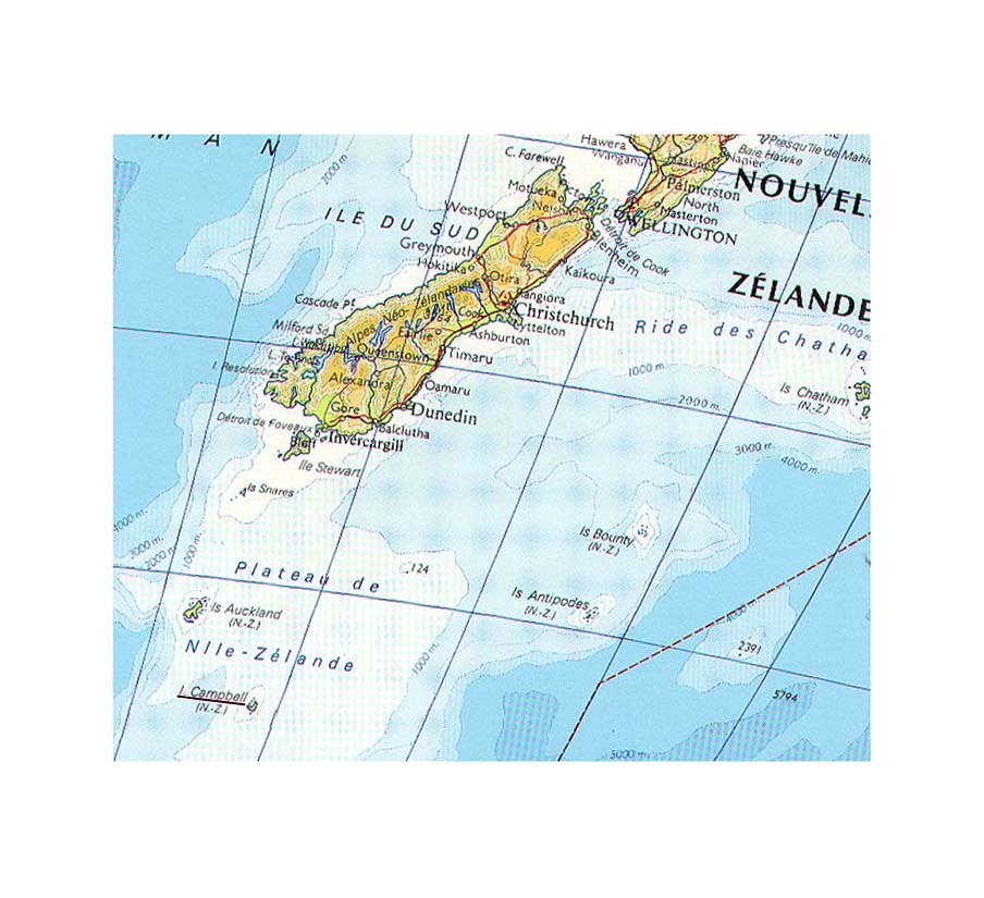
gravesite had been rediscovered on remote sub-antartic Campbell Island (New Zealand) in 1993. Paul DURIS Born 9 march 1850 in Châteauroux (Indre). |
|||
The following is an account of the discovery of the grave. Mr Duris was a member of the crew aboard the French ship "Vire" which, in 1874, brought a scientific expedition, initiated by the Paris Académie des Sciences and led by Jacques Anatole Bouquet de la Grye, to Campbell Island. The expedition was to witness the transit of the planet Venus across the Sun. Unfortunately, the typical cloudiness of the island allowed only a small part of the event to be seen. Duris died of typhoid fever on 21 or 22 September and was buried at a place known as Duris Point. |
||||
The following photographs and texts are from Norman's collection. |
||||
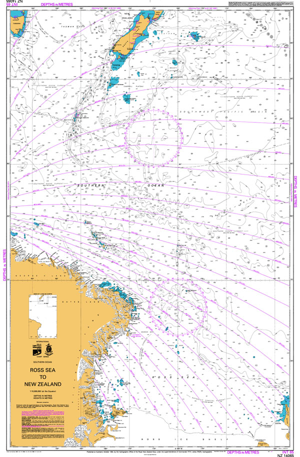
Campbell Island |
||||
 |
 |
|||
 |
||||
Bull Rock, Campbell Island. |
||||
Campbell Island can easily be described like nothing on earth - except perhaps the northern Shetlands. Winds that exceed hurricane force are common and each year only a little over 600 hours of direct sunlight reaches the island's surface. The island, which comes under New Zealand's Department of Conservation, is a Nature Reserve. It is currently uninhabited but when Norman visited the island on 6 occasions, he was able to live at the island's staffed weather station. |
 |
|||
Campbell Island north east coastline. |
||||
 |
 |
 |
||
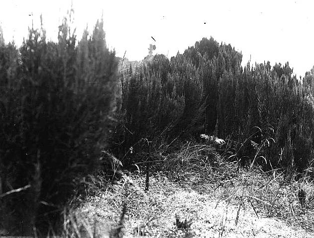
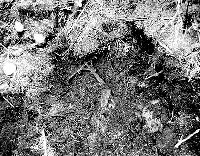
Paul Duris's grave |
||||
 |
 |
 |
||
1891 |
1905 |
1907 |
||
 |
Norman Judd's Story : |
|||
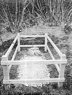 |
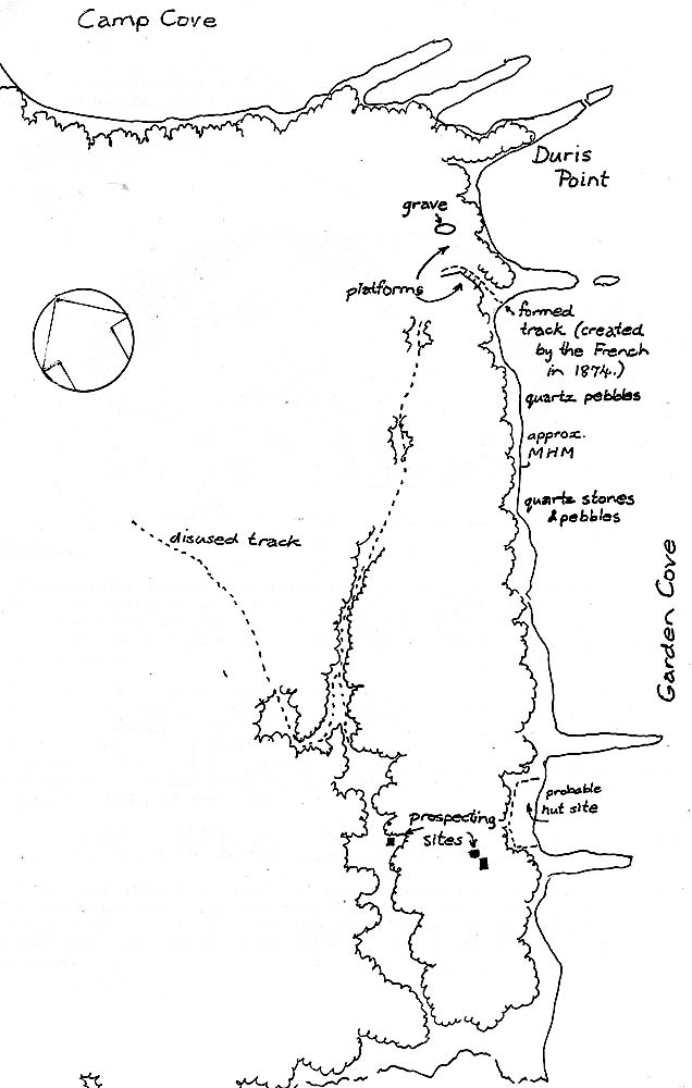
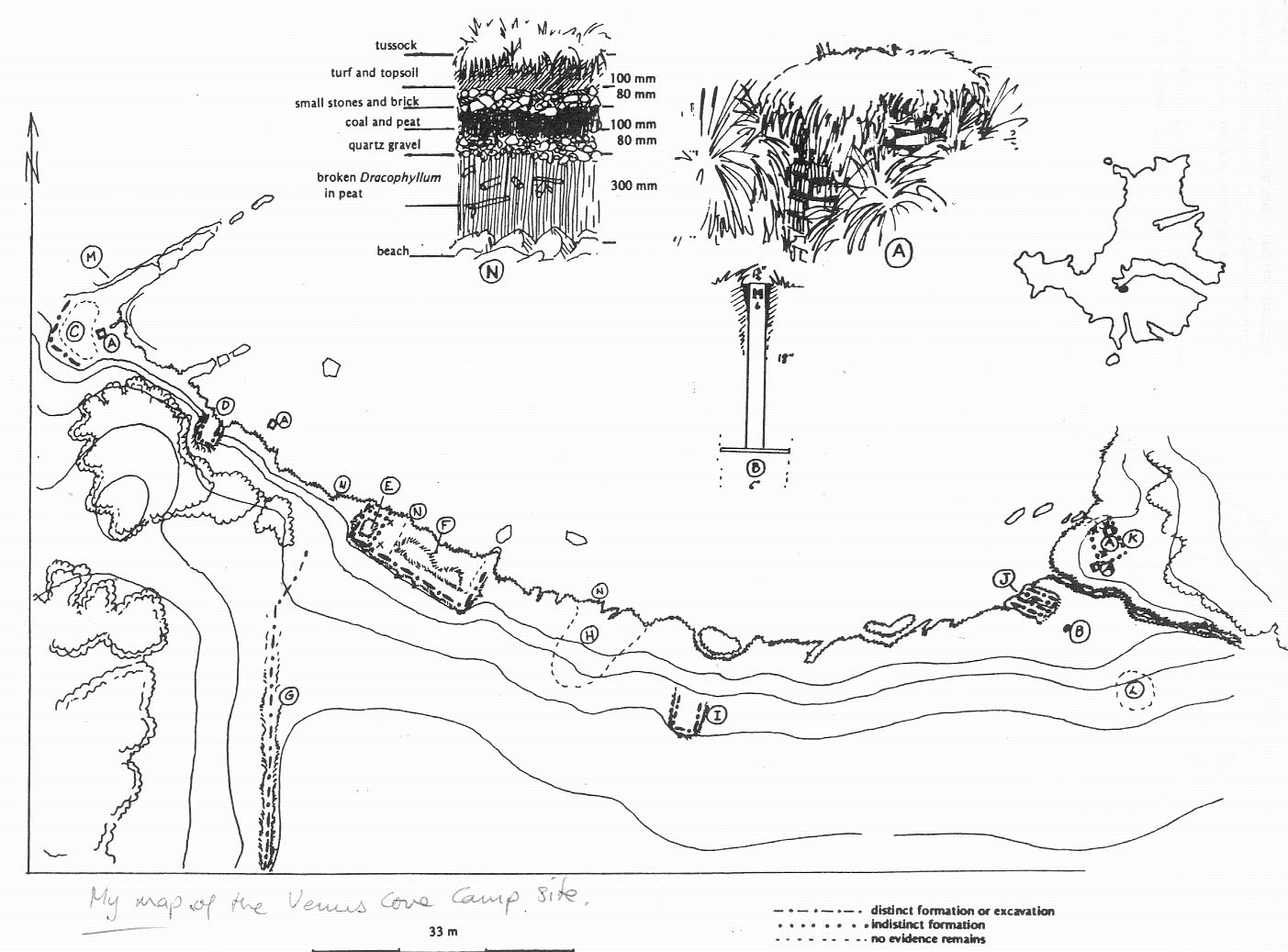
In 'Report On The Archaelogical Survey And Investigation Of Campbell Island - 1993 '. (by N. Judd) The Grave of M. Duris With the assistance of Mr Jim Henderson of the weather station, the grave was located by probing under a large Dracophyllum tree - three metres from the last position of the step ladder. The probe first struck the mound’s surface 300mm below ground level. Turf Lifting Once the permission was obtained from the Historic Places Trust through the Southland Office of the Department of Conservation, the Dracophyllum was cleared from the site and the soft covering of humus peeled back from the cross with bare hands. In this way the rocks at the head of the grave and the cross were revealed 'in situ'. The cross, in an exceptionally uncorroded condition, was leaning against the bank behind as if it had been pushed back. The site was then photographed and then covered by protective boughs of scrub and the ladder. The following day and with the assistance of Mr Steven Taylor, also of the weather station, the grave's surface was carefully cleared by hand, measured and photographed. About 1.5 cubic metres of peat was removed from over the tomb. The vertical depth of peat over the mound had measured 350mm at the head of the grave and 300mm at the foot. Careful lifting of the last 100mm of peat failed to locate anything other than the layer of white quartz pebbles laid during the latter farming years, (1920-31) and a fine layer of charcoal and ash around the outside boundaries of the mound. When post holes were dug for the fence another layer of ash was located 1-200mm further down. After it had been photographed, the cross was removed from the head stones and then cleaned, oiled and replaced. During this operation four thin pieces of rusty metal were discovered under the head stones and these were brought to New Zealand to be analysed. Dr Nigel Pickett believed them to be similar to tin match box segments. Light tin match boxes were evident around the turn of the century. However, there are indications of rivets in this metal. Protective fence Mr Taylor helped to build a protective fence prefabricated at the Station the previous day. The following day a stainless steel plaque engraved with the name of Duris and the date of his death, was fastened to one of the top railings. The Mound The 'mound', apart from its border, was not completely the shape of a traditional tomb. The grave's surface was dished across its length. This is probably because Hooker Sea Lions (Phocarctos hookeri) used the terrace on which the grave was situated to traverse to the higher ground above. Three sea lions endeavoured to cross over the site while it was in the process of being revealed and restored. A new layer of white beach pebble covers the old ones. Two other important features were found near the grave. These were the track and building platform prepared by the crew of the Frigate VIRE, in 1873, for the 1874 French Transit of Venus Expedition, (B. de la Grye, 1875). These are shown on the map of the area. |
 |
||
|
||||
The gravesite in 2003 |
 |
 |
|
2012-07-04 Group at cross after the grave side service |
2012-07-04 Rotoiti and Taupo IPVs (Inshore Patrol Vessels) at anchor |
|
 |
 |
|
2012-07-04 IPVs's medallions |
2012-07-04 Navy Commander Brett |
Venus Cove
and the expedition to witness the transit of the planet Venus.

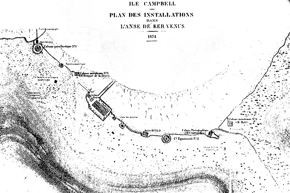
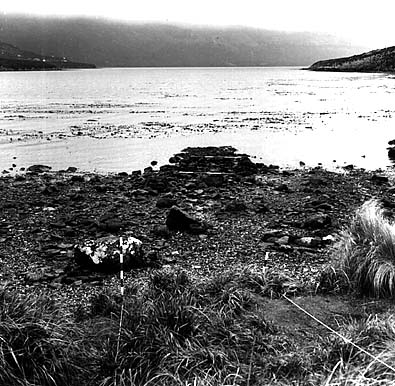
Remains of the installations
(Norman's plan)
Plan of installations in Venus Cove
(Anse des Kervenus)1874.
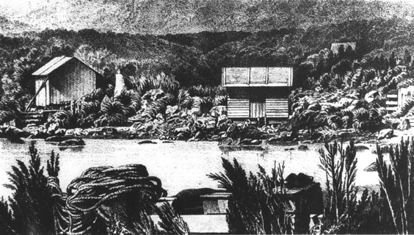


from right to left:
Cabane photographique
Lunette méridienne du Bureau (Hatt)
The main camp buildings in the centre of Venus Cove
(apparently the main building was
carried in sections from Bordeaux).
from right to left:
Magasin, cuisine, four
Maison d'habitation
Cabane des pendules, bouteilles
Abri pour les moutons.
The buildings on the east side of the camp.
from right to left:
Maregraph
Equatorial (8 inches)
Lunette méridienne du dépôt.
(Bouquet de La Grye)


The expedition to witness the transit of the planet Venus across the Sun on Campbell Island(1874).
Paul DURIS

Any available information about Mr. Paul Duris or his descendants would be welcome, please contact us
